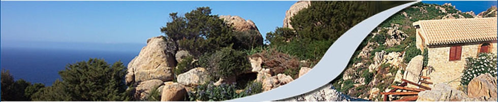
 Costa Paradiso - Sardinia
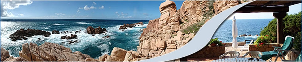 Costa Paradiso - Sardinia
 Costa Paradiso - Sardinia
 Costa Paradiso - Sardinia
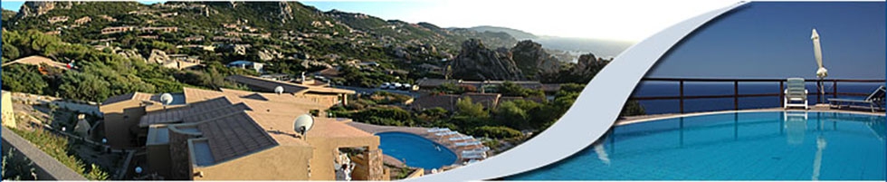 Costa Paradiso - Sardinia
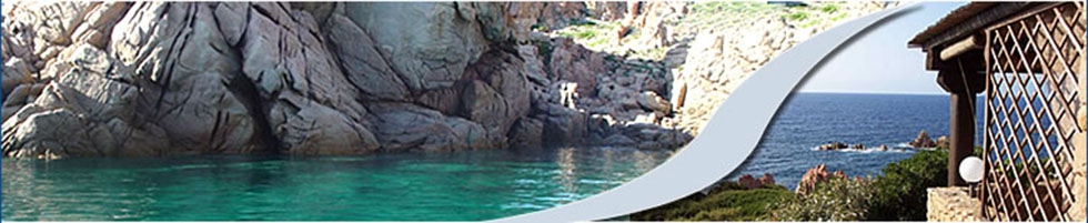 Costa Paradiso - Sardinia
Surroundings
Where to go: Badesi
Costa Paradiso-Badesi
20 minutes by car; fine sandy beach (12 km), several good restaurants, horse riding stables with the possibility of beach rides, surfing, wind-surfing, kite-surfing, surf-casting, canoeing.
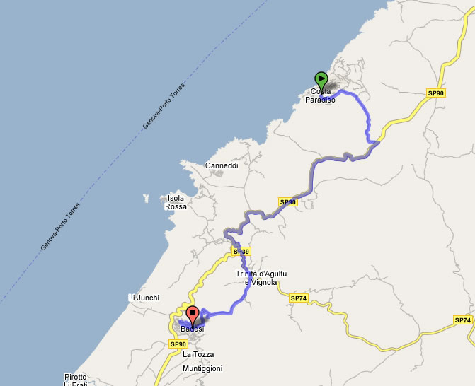 Click on the map
 Badesi can be easily reached from the main ports and airports of the north part of the island. Geographically it is located between Castelsardo and Santa Teresa di Gallura, 50 km from Porto Torres and 85 km from Olbia. Once on the island you can drive to Badesi in 50 minutes.
The municipality of Badesi covers an area of 30 sq km and a variety of landscapes, from lush hills to sandy plains covered with wine producing vineyards to the alluvial plain of the river Coghinas with artichoke plantations.
The town centre is situated on a gentle slope with a panoramic view of the plain beneath, of the gulf of Asinara and of Corsica. The village is surrounded by four suburban neighborhoods: Lu Muntiggiu, La Tozza, Muntiggioni, Azzagulta, situated on other panoramic hills.
The beach is the main attraction.
12 Km long and made of white ultrafine sand, a wide beach with sand dunes covered with old junipers shaped by the wind. The sea has shades of blue, transparent waters and is abundant in fish. Seasonally it attracts international surf-casting enthusiasts. The ever present wind makes this location also a favorite with windsurfers and kitesurfers.
Where to Go: Castelsardo
Costa Paradiso-Castelsardo
30 minutes by car, rich historical heritage, famous for coral manufacturing, restaurants, tourist port and beaches.
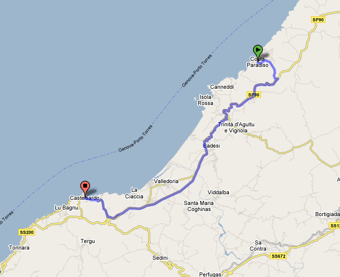 Click on the map
The name comes from the second half of the XVIII century, when it was changed from the original name Castell'Aragonese, forced upon during the Spanish conquest of the island. The origins are even older, it was founded by the powerful Doria family from Genoa 1000 years ago and then it was named Castelgenovese.
The centre is the most interesting and unique part of the village, with old buildings perfectly preserved including the churches and the castle, built on the top of the hill and dominating the coastline. Today the castle of Castelsardo hosts a museum called “Intreccio”, that contains exhibits created by the hands of the Sardinian artisans weaving the humble stems that they found in nature.
Where to Go: Isola Rossa
Costa Paradiso-Isola Rossa
20 minutes by car, beaches, surfing, windsurfing, canoeing, jet ski, clear-bottom boat trips, restaurants, bars, parking.
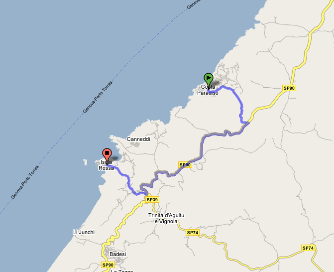 Click on the map
Municipality: Trinità d' Agultu
Population: 1984
Area code: 079; Zipcode: 07038
Elevation: 365 m above sea level
Spiaggia Longa
A beach within a village that carries the same name, it is the main beach of Isola Rossa, bordered by the rocks called Li Bicchi Russi on one side and other rocks near the view-point on the other side. This beach is right behind the village so it is more crowded.
Beach: La Marinedda
Facilities: bar, sailing club, windsurfing and surfing.
Before you get to the village you have to turn right, it is a pleasant
beach with white sand and clear water bordered by the promontory of Punta
li Canneddi.
Isola Rossa was originally an old fishing village born around a XVI century Spanish Tower (Aragonese Tower). Isola Rossa has always been a sheltered bay used as a natural harbor.
It derives its name from the red rock island made of porphyry which is 400 m from the coast. The centre is dominated by the Spanish tower and is very busy during the summer months for the presence of two excellent beaches and the beautiful deep red rocks that make it one of the most famous tourist attractions in Sardinia.
Where to Go: Trinità D'Agultu
Costa Paradiso-Trinità d'Agultu
15 minutes by car, shopping, restaurants, bar, parking (for beaches see Isola Rossa).
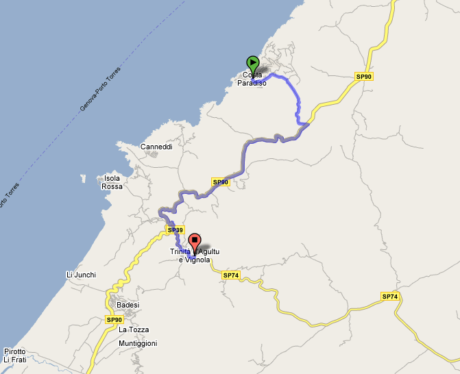 Click on the map
Municipality: Trinità d' Agultu
Population: 1984
Area code: 079; Zipcode: 07038
Elevation: 365 m above sea level
The municipality of Trinità d'Agultu covers part of the area of Vignola, in Gallura, and it extends along the Golfo di Asinara, in the north of the island.
The landscape is varied, from long wild and uncontaminated beaches with fine white sand and inland areas of great historical and cultural interest that testify a remote human presence on the island. More than half of the area has been classified by the European Union as a site of special interest for the Community.
Trinità d’Agultu has a population of almost 2000 people and is situated on a plateau at 365 m above sea level and only 4 km from the coast. It is a very attractive resort provided with good touristic and residential facilities and situated on a beautiful coastline.
Driving towards Santa Teresa di Gallura after 10 km you will discover a magnificent scenery of villas hidden among yellow and pink granite rock formations and that is Costa Paradiso.
Where to Go: Vignola
Costa Paradiso-Vignola/Aglientu
10 minuti di macchina, Spiaggia, wind-surf, campeggio, ristoranti, agriturismo, bar, parcheggio, divieto animali.
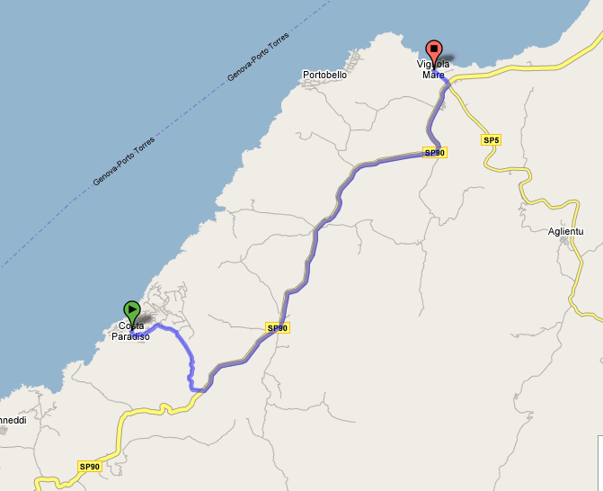 Click on the map
Municipality: Aglientu
Population: 1086
Area code: 079; Zipcode: 07020
Elevation: 472 m above sea level.
Sandy beach close to the little harbour, Sotto la Punta di Li Francesi, 9 Km. from Aglientu. The intersection for Vignola is 19 km from S. Teresa di Gallura, on the road to Castelsardo.
Aglientu is 149 sq km with a population of 1100 residents. It is situated in the province of Sassari on the north western coast, 28 km from Santa Teresa, in a unique landscape of granite rocks and oak trees. The coastline is 18 km long with beaches, rocks and a pine forest which extends for 8 km. The sea is clear and abundant in fish. Along the coast are the sea resort villages of Portobello, Vignola and Rena Majore and the campsites Tortuga, Saragosa, Marina delle Rose.
Human presence in the Aglientu territory left ancient traces like the many “nuraghe” – very simple ancient fortified dwellings. Some have been destroyed and some are still well preserved like the nuraghe of Tuttusoni, Finucchiaglia and Cugara, on the coast that extends from Portobello to Rena Majore. The village of Aglientu boasts two typical restaurants, a trattoria and a pizzeria. In the last few years several agritourism resorts have been created, they are very popular with tourists especially because they preserve the traditional cuisine from Gallura.
Sightseeing
Church of S. Pancrazio, Vignola, beach of Rena Majore.
The best nuraghi are "Tuttusoni", "Finucchjaglia", "Nieddu" and "La
Foci".